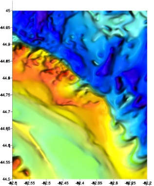
This bathymetric (depth) contour map represents a 30-mile segment of the Huron Ridge in mid-Lake Huron. Color-coded depths range from 40 ft. (dark red) to over 500 ft. (dark blue). The shallowest features include the "Six-Fathom Bank" area. Steep walls line the northern side of the ridge.